
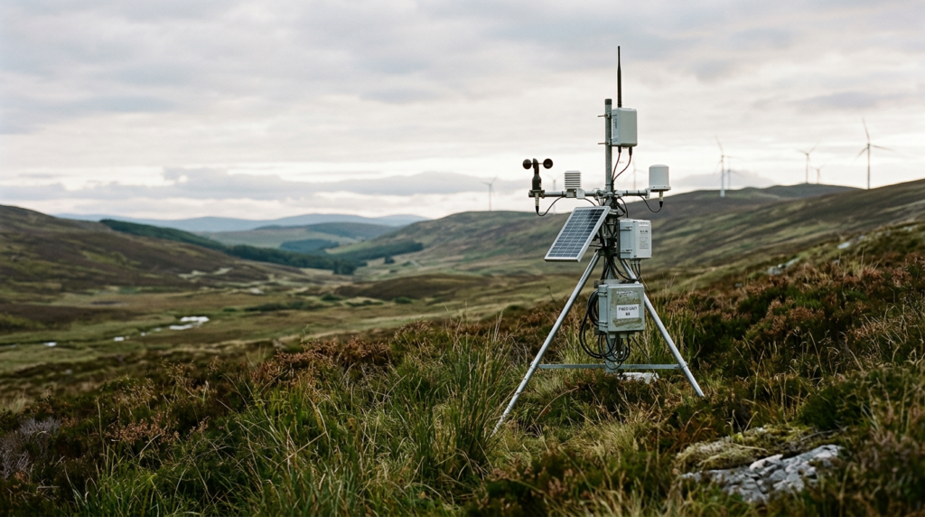
Understanding MRV and the Transition to Digital Systems
Measurement, reporting, and verification (MRV) forms the operational foundation of carbon accounting, environmental attribute tracking, and carbon credit issuance. In carbon removal and emissions reduction projects, MRV proves that a stated volume of greenhouse gas was removed from the atmosphere or avoided entirely. For decades, legacy MRV processes depended on manual fieldwork, disparate spreadsheets, periodic paper reports, and episodic site visits by third-party auditors. These traditional workflows often take months or years to move from field activities to verified credits, inflating administrative costs and introducing human error.
Digital Measurement, Reporting, and Verification (dMRV) replaces manual, fragmented accounting with structured, auditable digital architecture. By combining ground-level hardware, remote sensing, automated data pipelines, and programmatic registry integrations, dMRV transforms static project documentation into continuous, transparent data streams. For project developers, buyers, and regulatory authorities, understanding how each layer in the dMRV stack operates is critical for evaluating the credibility and permanence of environmental assets.
The Core Challenges of Legacy MRV
Traditional MRV was designed when carbon markets were small and transactions were bespoke. As compliance obligations under systems such as the European Union’s Carbon Border Adjustment Mechanism (CBAM) expand and corporate demand for high-integrity credits increases, the friction inherent to legacy systems creates distinct operational bottlenecks:
- Temporal Lag: Manual sampling campaigns often occur months after project interventions take place. By the time data is collated, reviewed, and audited, the underlying ecosystem or industrial operational parameters may have shifted.
- High Transaction Costs: Deploying physical inspection teams to remote forestry plots, agroforestry initiatives, or distributed biochar production sites carries heavy travel and labor expenses, often rendering small-scale projects financially non-viable.
- Data Asymmetry and Tampering Risk: Hand-entered field records and static spreadsheets lack cryptographic integrity, immutable timestamps, or automated validation, increasing the surface area for recording errors or reporting bias.
- Verification Bottlenecks: Validation and Verification Bodies (VVBs) must spend significant billable hours conducting basic data provenance checks, reconciling file versions, and tracking calculation steps, which delays final credit issuance.
dMRV does not eliminate the need for rigorous standards or independent oversight; instead, it automates the collection, calculation, and packaging of primary evidence so that project performance can be assessed with greater accuracy and lower friction.
The dMRV Stack: An End-to-End Architectural Breakdown
A comprehensive dMRV system is structured across five sequential functional layers. Each layer contributes to a verifiable chain of custody, ensuring that raw physical events translate cleanly into certified environmental assets.
Layer 1: Field Data Collection and IoT Sensors
At the base of the dMRV stack is the physical event where carbon is either sequestered, avoided, or mineralized. Capturing these physical parameters requires connected hardware, ruggedized telemetry, and structured data-entry tools operating at the source.
In industrial carbon removal, such as biomass pyrolysis for biochar production, sensors monitor operational parameters continuously. Thermocouples measure reactor temperatures to ensure production meets required carbon stability thresholds, automated scales log dry biomass input and biochar output weights, and digital flow meters record quench water and fuel usage. This data is logged directly from programmable logic controllers (PLCs) or edge telemetry devices, bypassing manual record books.
In nature-based and agricultural contexts, primary data capture often relies on offline-first mobile applications configured with strict validation rules. Field technicians record tree species, diameter at breast height (DBH), canopy metrics, or soil core sample identifiers using GPS-stamped, time-stamped mobile interfaces. When devices reconnect to cellular or satellite networks, the raw data packets sync automatically with the platform, preventing back-dated or geofence-violating entries.
Layer 2: Remote Sensing and Earth Observation
For spatial interventions—such as afforestation, reforestation, improved forest management (IFM), and soil carbon projects—ground sensors are paired with Earth observation data to provide continuous, landscape-scale coverage. Remote sensing acts both as a primary measurement tool and as an ongoing surveillance mechanism to detect disturbances like fire, drought stress, illegal logging, or pest infestations.
The optical and radar layers commonly utilized include:
- Multispectral Satellite Imagery: Public constellations (such as Sentinel-2 and Landsat) along with commercial high-resolution providers offer spectral bands for calculating vegetation health indices, such as the Normalized Difference Vegetation Index (NDVI) and Enhanced Vegetation Index (EVI).
- Synthetic Aperture Radar (SAR): Satellite radar systems, such as Sentinel-1, penetrate cloud cover and provide structural information about canopy density, surface roughness, and moisture levels, ensuring continuous monitoring even in tropical regions with persistent cloud layers.
- LiDAR (Light Detection and Ranging): Deployed via aircraft, drones, or spaceborne platforms (like NASA’s GEDI mission), LiDAR produces 3D point clouds that directly measure forest canopy height and vertical vegetation structure, allowing for precise biomass volume estimation.
By integrating high-frequency satellite data with ground calibration plots, dMRV platforms construct stratified sampling regimes that reduce the need for exhaustive ground measurements while maintaining strict confidence intervals.
Layer 3: Data Ingestion, Quality Control, and Methodological Modeling
Raw sensor readings, satellite tiles, and field logs must be aggregated, normalized, and transformed into greenhouse gas metrics. This layer functions as the computational engine of the dMRV platform.
Upon ingestion, data undergoes automated quality assurance and quality control (QA/QC). The system checks for anomalies, such as sensor calibration drift, missing timestamps, duplicate records, or spatial discrepancies where field points fall outside defined project boundaries. Flagged data points are routed to administrative queues for review rather than passing silently into the accounting engine.
Once validated, the platform applies approved methodologies codified into algorithmic models. Standard crediting bodies—such as Verra, Gold Standard, Puro.earth, the Climate Action Reserve, and national programs like India’s Green Credit Programme—publish detailed mathematical equations governing baseline determinations, project emissions, leakage deductions, and permanence buffers. In a dMRV architecture, these programmatic models take the verified raw inputs and compute net carbon removals or emissions reductions according to standard rules, creating transparent intermediate values for every calculation step.
Layer 4: Reporting and Immutable Audit Trails
Measurement data is only as valuable as its defensibility. The fourth layer organizes calculations into standardized reporting formats while maintaining a complete, tamper-resistant lineage of all underlying evidence.
Rather than assembling monitoring reports manually at the end of a multi-year crediting cycle, the dMRV system compiles evidence packages dynamically. The platform generates monitoring reports containing complete operational histories, spatial shapefiles, calibration certificates, and raw sensor data logs. Every transformation—from raw sensor millivolt reading to metric ton of carbon dioxide equivalent (tCO2e)—is stored with its associated code version, model parameters, and operator metadata.
This immutable audit trail ensures that if a baseline formula is refined or a sensor is retroactively found to have drifted, auditors and platform operators can trace the exact impact on the computed balance without reconstructing the entire project record from scratch.
Layer 5: Third-Party Verification and Registry Integration
The final layer connects the digital project record with the institutions responsible for validating claims and issuing market instruments. This layer serves two primary users: Validation and Verification Bodies (VVBs) and carbon crediting registries.
VVBs access the platform through dedicated auditor portals. Instead of reading through hundreds of pages of static PDFs and cross-referencing detached data tables, auditors review structured digital files, inspect visual spatial overlays, and execute targeted sampling routines across the underlying datasets. Auditors can query specific anomalies, review automated QA/QC flags, and verify that methodological rules were executed properly in code.
Once the VVB signs off on the monitoring report, the dMRV platform connects directly via Application Programming Interfaces (APIs) to carbon registries or national environmental accounting databases. The platform submits verified removal quantities alongside unique serial identifier requests, retiring intermediate project tokens or minting certified credits directly into registry accounts. This integration closes the loop, reducing the friction and administrative lag historically found between verification sign-off and issuance.
The Strategic Value of dMRV for Corporate and Regulatory Compliance
While dMRV originally emerged to serve voluntary carbon market integrity, its applications have expanded rapidly across compliance reporting, green finance, and corporate sustainability disclosures.
Under the International Sustainability Standards Board (ISSB) frameworks—specifically IFRS S1 and IFRS S2—enterprises must disclose material climate-related risks, Scope 1, 2, and 3 greenhouse gas emissions, and the credibility of any transition plans relying on carbon offsets. Financial auditors assessing these corporate filings require auditable internal controls over environmental data that mirror controls over financial reporting. Static spreadsheets and unverified developer claims pose substantial balance-sheet and reputational risks under strict regulatory scrutiny.
Similarly, financial institutions subject to IFRS 9 impairment considerations or IFRS 7 disclosure standards must evaluate the performance and physical risks associated with collateralized sustainability-linked assets. A verifiable dMRV stack provides continuous asset-level visibility, verifying whether an agricultural or biochar asset is delivering on its promised environmental yield or facing operational distress.
Implementing dMRV: Key Considerations for Project Developers
Deploying a digital MRV framework requires careful planning around technical, physical, and methodological alignment. Project teams evaluating dMRV implementation should address several core requirements:
- Sensor Reliability and Calibration: Edge devices and industrial sensors must withstand local environmental conditions, from high-heat industrial biochar environments to humid agricultural landscapes. Establish strict calibration schedules and automated alerting for device dropouts.
- Data Governance and Interoperability: Ensure that the chosen dMRV system exports data using open standards and structured formats (such as JSON, GeoJSON, and standardized REST APIs) to avoid vendor lock-in and simplify long-term registry alignment.
- Methodological Alignment: A dMRV system must strictly reflect the standard methodology governing the specific project type. Hardcoding calculations without accommodating updates to standard baseline methodologies can result in non-compliant submissions during registry review.
- Connectivity Realities: Remote project sites often lack stable internet infrastructure. Field tools must support offline caching, local data encryption, and automatic reconciliation once network connectivity is re-established.
The Future of Digital Environmental Assurance
As carbon markets mature and regional compliance regimes integrate environmental credits into cross-border trade mechanisms, the tolerance for opaque, unverifiable claims is disappearing. Buyers, financial auditors, and regulators require environmental data that is continuous, verifiable, and programmatically connected to physical actions on the ground.
By unifying field telemetry, Earth observation, automated calculation models, and registry workflows, dMRV builds the data integrity necessary for environmental markets to function with the transparency of traditional financial systems. Transitioning to digital MRV is no longer an optional technical upgrade; it is the prerequisite for building defensible, institutional-grade environmental assets.
To evaluate how ForestTwin’s dMRV platform and advisory services can structure, monitor, and verify your carbon removal or corporate sustainability initiatives, contact our technical team at https://foresttwin.com/contact/.